
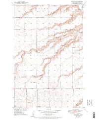
2018 Map of Robinson Coulee
USGS Topo · Published 2018About this map
Robinson Coulee and Bonnes Coulee define the drainage patterns of this rural Ward County landscape, where the prairie is carved by a network of seasonal watercourses. The terrain is characterized by numerous small potholes and wetlands typical of the North Dakota drift plain, scattered throughout the southern half of the map. This 2018 survey reveals a sparse settlement pattern dominated by a strict sectional road grid, including 233rd Ave SE and 317th Ave SE, which provide access to isolated agricultural homesteads. The intersection of these local routes with regional thoroughfares like Co Hwy 25 and Co Hwy 24 underscores the area's continued reliance on a traditional land-survey system established over a century prior.
Find a feature on this map
21 named features on this map. Tap any name to fly to it.
Don’t see what you’re looking for? This feature index may not catch every label — zoom into the map to look around manually.
Map Details
Editions of this 2018 Robinson Coulee Map
This is the sole edition of this map. No revisions or reprints were ever made.
Other maps of this area

1929 · Sawyer
USGS Topo · 1:62,500

1929 · Benedict
USGS Topo · 1:62,500

1929 · Kongsberg
USGS Topo · 1:62,500

1948 · Velva
USGS Topo · 1:62,500

1948 · Sawyer
USGS Topo · 1:24,000

1949 · Sawyer
USGS Topo · 1:24,000

1949 · Velva
USGS Topo · 1:24,000

1949 · Sawyer
USGS Topo · 1:62,500
1950 · Sawyer SW
USGS Topo · 1:24,000

1951 · Velva
USGS Topo · 1:62,500