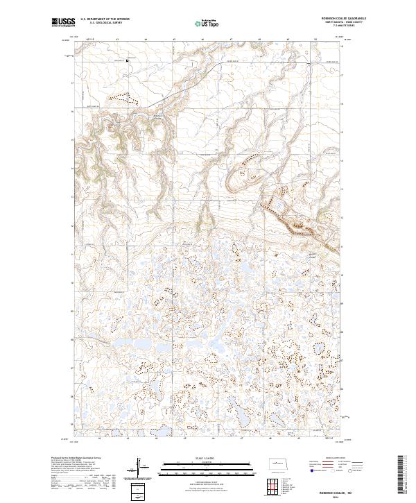
2024 Map of Robinson Coulee
USGS Topo · Published 2024About this map
Solem Cem sits in the northern reaches of this Ward County landscape, a marker of early settlement amidst a high concentration of prairie potholes and wetlands. The southern half of the quadrangle is dominated by an intricate network of small lakes and water bodies, many of which fall within the Ward County Waterfowl Production Area. This topographic survey illustrates the transition from the drainages of Robinson Coulee and Bowers Coulee in the north to the saturated, depressional terrain to the south. A rigid grid of section-line roads, including Co Hwy 22 and Co Hwy 24, provides access across the township lines of t152n r82w and t151n r81w, showing how modern infrastructure navigates the complex hydrology of the North Dakota prairie.
Find a feature on this map
24 named features on this map. Tap any name to fly to it.
Don’t see what you’re looking for? This feature index may not catch every label — zoom into the map to look around manually.
Map Details
Editions of this 2024 Robinson Coulee Map
This is the sole edition of this map. No revisions or reprints were ever made.
Other maps of this area

1929 · Sawyer
USGS Topo · 1:62,500

1929 · Benedict
USGS Topo · 1:62,500

1929 · Kongsberg
USGS Topo · 1:62,500

1948 · Velva
USGS Topo · 1:62,500

1948 · Sawyer
USGS Topo · 1:24,000

1949 · Sawyer
USGS Topo · 1:24,000

1949 · Velva
USGS Topo · 1:24,000

1949 · Sawyer
USGS Topo · 1:62,500
1950 · Sawyer SW
USGS Topo · 1:24,000

1951 · Velva
USGS Topo · 1:62,500