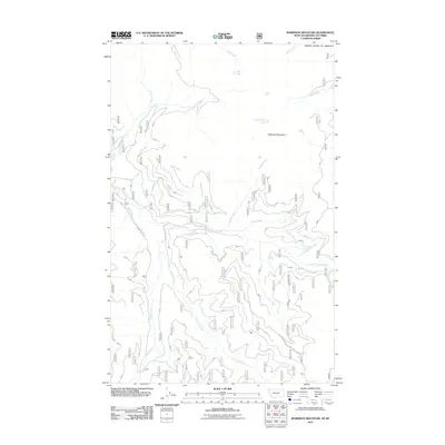
2011 Map of Robinson Mountain
USGS Topo · Published 2011About this map
Robinson Mountain dominates this portion of Lincoln County, Montana, just south of the international border with the United States of America. The landscape is defined by the complex drainage network of the East Fork Yaak River, where numerous tributaries like Porcupine Creek, Basin Creek, and Caribou Creek carve through the high-elevation terrain. This 2011 survey captures the area's wilderness character, marked by remote water bodies such as Gold Lake and Plumb Bob Lake. Access is limited to a few documented routes, including Mac Intyre Rd and Natl Forest Develop Road 750A Rd. The map illustrates the rugged hydrology of the northern Rockies, showing the descent of streams like Gold Creek and Sink Creek toward the Canadian border. It is a precise record of the Kootenai National Forest's backcountry, where the network of forest development roads provides the only modern footprint on an otherwise isolated mountain landscape.
Find a feature on this map
21 named features on this map. Tap any name to fly to it.
Don’t see what you’re looking for? This feature index may not catch every label — zoom into the map to look around manually.
Map Details
Editions of this 2011 Robinson Mountain Map
This is the sole edition of this map. No revisions or reprints were ever made.
Other maps of this area

1957 · Kalispell
USGS Topo · 1:250,000

1960 · Kalispell
USGS Topo · 1:250,000

1961 · Kalispell
USGS Topo · 1:250,000

1963 · Robinson Mountain
USGS Topo · 1:24,000

1963 · Red Mountain
USGS Topo · 1:24,000

1963 · Webb Mountain
USGS Topo · 1:24,000

1963 · Boulder Lakes
USGS Topo · 1:24,000

1963 · Mount Henry
USGS Topo · 1:24,000

1963 · Lost Horse Mountain
USGS Topo · 1:24,000

1979 · Yaak River
USGS Topo · 1:100,000