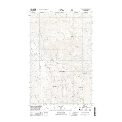
2014 Map of Robinson Mountain
USGS Topo · Published 2014About this map
Kootenai National Forest dominates this high-elevation landscape within the Purcell Mountains of Lincoln County. The 2014 survey reveals a complex drainage network defined by the E Fork Yaak River and its numerous tributaries, including Caribou Cr, Hubbard Cr, and Hudson Creek. Alpine features like Lake Geneva, Plumb Bob Lake, and Gold Lake are situated among the peaks, with Robinson Mtn serving as a primary topographical landmark. This modern topographic record illustrates the intricate system of logging and access routes, such as Natl Forest Develop Road 92 Rd and Natl Forest Develop Road 750 Rd, which facilitate movement through the dense timberlands. The map serves as a precise guide to the remote watersheds and ridges that characterize this northern Montana border region.
Find a feature on this map
32 named features on this map. Tap any name to fly to it.
Don’t see what you’re looking for? This feature index may not catch every label — zoom into the map to look around manually.
Map Details
Editions of this 2014 Robinson Mountain Map
This is the sole edition of this map. No revisions or reprints were ever made.
Other maps of this area

1957 · Kalispell
USGS Topo · 1:250,000

1960 · Kalispell
USGS Topo · 1:250,000

1961 · Kalispell
USGS Topo · 1:250,000

1963 · Robinson Mountain
USGS Topo · 1:24,000

1963 · Red Mountain
USGS Topo · 1:24,000

1963 · Webb Mountain
USGS Topo · 1:24,000

1963 · Boulder Lakes
USGS Topo · 1:24,000

1963 · Mount Henry
USGS Topo · 1:24,000

1963 · Lost Horse Mountain
USGS Topo · 1:24,000

1979 · Yaak River
USGS Topo · 1:100,000