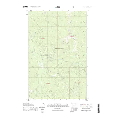
2020 Map of Robinson Mountain
USGS Topo · Published 2020About this map
Kootenai National Forest dominates this section of the Purcell Mountains in Lincoln County, Montana. The topography is defined by the high peaks of Robinson Mountain and Robinson Mtn, which overlook a complex network of glacial lakes including Lake Geneva, Geneva Lake, Gold Lake, and Plumb Bob Lake. This landscape is primarily accessible via a series of National Forest Development Roads, such as Natl Forest Develop Road 5800 Rd, which navigate the steep drainage basins of the E Fork Yaak River. The inclusion of the Dodge Summit Trail highlights the importance of traditional backcountry routes through the high country. Numerous smaller watercourses like Hubbard Cr, Porcupine Cr, and Fast Cr feed into the larger river systems, illustrating the area's role as a vital watershed in the far northwestern corner of the state.
Find a feature on this map
33 named features on this map. Tap any name to fly to it.
Don’t see what you’re looking for? This feature index may not catch every label — zoom into the map to look around manually.
Map Details
Editions of this 2020 Robinson Mountain Map
This is the sole edition of this map. No revisions or reprints were ever made.
Other maps of this area

1957 · Kalispell
USGS Topo · 1:250,000

1960 · Kalispell
USGS Topo · 1:250,000

1961 · Kalispell
USGS Topo · 1:250,000

1963 · Robinson Mountain
USGS Topo · 1:24,000

1963 · Red Mountain
USGS Topo · 1:24,000

1963 · Webb Mountain
USGS Topo · 1:24,000

1963 · Boulder Lakes
USGS Topo · 1:24,000

1963 · Mount Henry
USGS Topo · 1:24,000

1963 · Lost Horse Mountain
USGS Topo · 1:24,000

1979 · Yaak River
USGS Topo · 1:100,000