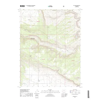
2019 Map of Roc Creek
USGS Topo · Published 2019About this map
Manti-La Sal National Forest encompasses much of this 2019 survey, characterized by the dramatic geological formations of the Colorado-Utah border region. The landscape is defined by massive structural features like Sinbad Ridge and Sewemup Mesa, which separate the expansive Sinbad Valley from the Paradox Valley to the south. Waterways including the Dolores River and Roc Creek have carved deep incisions through the terrain, most notably at Red Canyon and Sunrise Canyon. The map reveals a network of primitive access routes, such as Q13 Rd and T6 Rd, tracing the high ground of Carpenter Ridge and the broad expanses of Carpenter Flats. This region’s layout demonstrates the characteristic salt tectonics of the area, where collapsed anticlines have created isolated, sunken valleys surrounded by high sandstone walls.
Find a feature on this map
28 named features on this map. Tap any name to fly to it.
Don’t see what you’re looking for? This feature index may not catch every label — zoom into the map to look around manually.
Map Details
Editions of this 2019 Roc Creek Map
This is the sole edition of this map. No revisions or reprints were ever made.
Other maps of this area

1885 · La Sal
USGS Topo · 1:250,000

1916 · Paradox Valley
USGS Topo · 1:125,000

1922 · Paradox Valley
USGS Topo · 1:125,000

1948 · Roc Creek
USGS Topo · 1:24,000

1948 · Paradox
USGS Topo · 1:24,000

1949 · Davis Mesa
USGS Topo · 1:24,000

1949 · Paradox
USGS Topo · 1:24,000

1949 · Roc Creek
USGS Topo · 1:24,000

1949 · Juanita Arch
USGS Topo · 1:24,000

1949 · Red Canyon
USGS Topo · 1:24,000