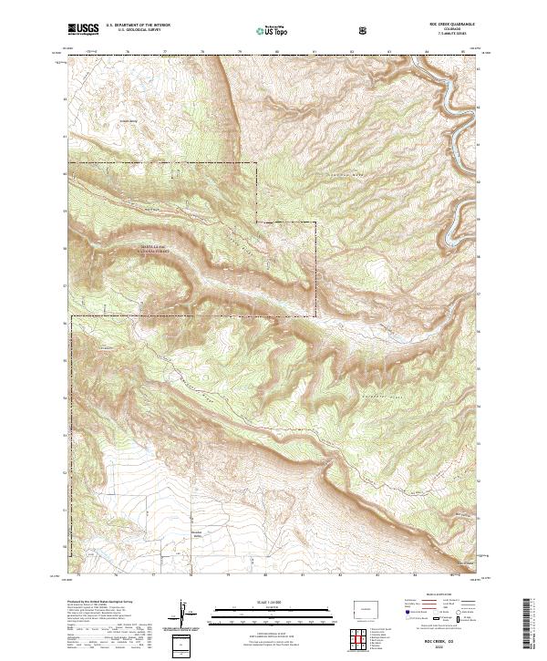
2022 Map of Roc Creek
USGS Topo · Published 2022About this map
Sinbad Valley and Paradox Valley dominate this corner of Montrose County, where the drainage patterns of Salt Cr and Roc Cr carve through high desert terrain. Part of the Manti-La Sal National Forest, the landscape is defined by massive formations like Sewemup Mesa and the long spine of Sinbad Ridge. The topographical data reveals a complex network of forest routes, including the Sinbad Ridge Trl and R3 Road Trl, which navigate the steep descents from Carpenter Ridge down to Carpenter Flats. The southwestern edge of the quadrangle shows the distinctive break at Hog Trough, illustrating the dramatic geologic shifts of this Colorado plateau region. The map provides a detailed record of 21st-century land management, showing the intersection of federal forest lands with the deep drainages of Garvey Gulch and W Paradox Cr.
Find a feature on this map
36 named features on this map. Tap any name to fly to it.
Don’t see what you’re looking for? This feature index may not catch every label — zoom into the map to look around manually.
Map Details
Editions of this 2022 Roc Creek Map
This is the sole edition of this map. No revisions or reprints were ever made.
Other maps of this area

1885 · La Sal
USGS Topo · 1:250,000

1916 · Paradox Valley
USGS Topo · 1:125,000

1922 · Paradox Valley
USGS Topo · 1:125,000

1948 · Roc Creek
USGS Topo · 1:24,000

1948 · Paradox
USGS Topo · 1:24,000

1949 · Davis Mesa
USGS Topo · 1:24,000

1949 · Paradox
USGS Topo · 1:24,000

1949 · Roc Creek
USGS Topo · 1:24,000

1949 · Juanita Arch
USGS Topo · 1:24,000

1949 · Red Canyon
USGS Topo · 1:24,000