Loading...
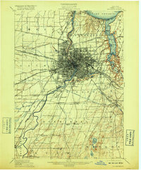
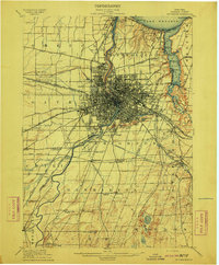
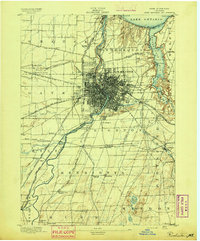
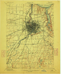
Loading map...1912 Map of Rochester
USGS Topo · Published 1917About this map
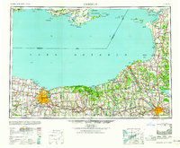
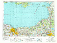
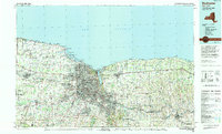
Rochester dominates this regional survey, showing the city's complex industrial and transit network just as the new Barge Canal was being established. The landscape is defined by the sharp gorge of the Genesee River and the sweeping shoreline of Lake Ontario, where recreational spots like Sea Breeze and Durand Eastman Park provided a coastal escape. A transition in New York's maritime history is visible as the original Erie Canal cuts through the city center while the newer canal route bypasses to the south near Genesee Junction.
Find a feature on this map
85 named features on this map. Tap any name to fly to it.
Don’t see what you’re looking for? This feature index may not catch every label — zoom into the map to look around manually.
Map Details
Date Portrayed1912
Date Published1917
PublisherU.S. Geological Survey
Map TypeTopographic
Scale1:62,500
Physical Dimensions16.6 x 20.1 inches
Editions of this 1912 Rochester Map
2 editions found
Historical Maps of Rochester Through Time
7 maps found

Featured Locations
Source Details
SourceU.S. Geological Survey
CopyrightPublic Domain