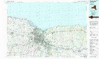
1984 Map of Rochester
USGS Topo · Published 1984About this map
The Genesee River cuts through the heart of Rochester before reaching Lake Ontario, anchoring a mid-1980s landscape defined by suburban expansion and industrial infrastructure. This survey captures the region's academic and social anchors, from the State University of New York at Brockport in the west to the Newark State School in the east. Along the shoreline, recreational and ecological zones like Hamlin Beach State Park and the Braddock Bay Wildlife Management Area contrast with the industrial presence of the Ginna Nuclear Power Plant.
Find a feature on this map
177 named features on this map. Tap any name to fly to it.
Don’t see what you’re looking for? This feature index may not catch every label — zoom into the map to look around manually.
Map Details
Editions of this 1984 Rochester Map
2 editions found
Other maps of this area

1895 · Rochester
USGS Topo · 1:62,500

1895 · Ontario Beach
USGS Topo · 1:62,500

1897 · Albion
USGS Topo · 1:62,500

1897 · Oak Orchard
USGS Topo · 1:62,500

1898 · Rochester
USGS Topo · 1:62,500

1899 · Hamlin
USGS Topo · 1:62,500

1899 · Ontario Beach
USGS Topo · 1:62,500

1899 · Brockport
USGS Topo · 1:62,500

1899 · Palmyra
USGS Topo · 1:62,500

1900 · Macedon
USGS Topo · 1:62,500