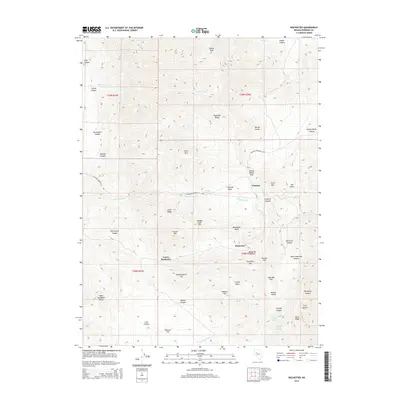
2014 Map of Rochester
USGS Topo · Published 2014About this map
Rochester and Lower Rochester sit within the high-desert terrain of the Humboldt Range in this modern survey of Pershing County. The map details a landscape defined by significant elevation changes, where features like Nenzel Hill, Independence Hill, and Gold Ridge overlook the mining-heavy district. The primary artery, the Lovelock-Unionville Rd, traverses the central part of the quadrangle, passing through Spring Valley Pass and providing a connection through the arid washes and basins. Water sources in this dry environment are noted by specific points such as McCarty Spring, Sage Hen Springs, and Mystic Spring, which historically supported the local mining operations and the settlement at Panama. Tracing the natural drainage reveals a network of canyons, including Rochester Canyon and Limerick Canyon, which flow into the larger Limerick Wash.
Find a feature on this map
55 named features on this map. Tap any name to fly to it.
Don’t see what you’re looking for? This feature index may not catch every label — zoom into the map to look around manually.
Map Details
Editions of this 2014 Rochester Map
This is the sole edition of this map. No revisions or reprints were ever made.
Other maps of this area

1931 · Lovelock
USGS Topo · 1:250,000

1935 · Lovelock
USGS Topo · 1:250,000

1954 · Unionville
USGS Topo · 1:62,500

1954 · Buffalo Mtn
USGS Topo · 1:62,500

1955 · Lovelock
USGS Topo · 1:250,000

1956 · Oreana
USGS Topo · 1:62,500

1956 · Lovelock
USGS Topo · 1:62,500

1959 · Lovelock
USGS Topo · 1:250,000

1984 · Lovelock
USGS Topo · 1:100,000
1987 · Rye Patch Dam
USGS Topo · 1:24,000