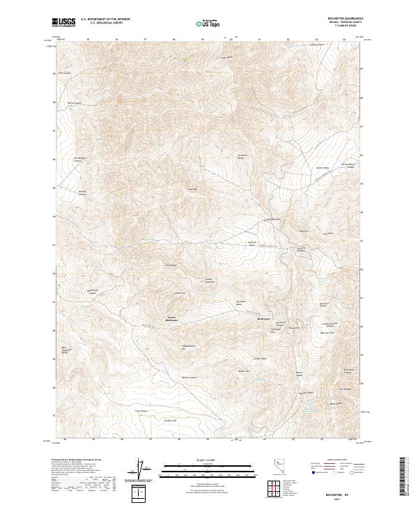
2021 Map of Rochester
USGS Topo · Published 2021About this map
Rochester and Lower Rochester sit within the high-desert terrain of the Humboldt Range, highlighting a landscape defined by its mining heritage and rugged topography. This 2021 survey illustrates a complex network of canyons and peaks, including Lincoln Hill and Nenzel Hill, which overlook the significant depressions of the Rochester Basin and Limerick Basin. The area is connected by historical thoroughfares such as the Lovelock-Unionville Rd and Rochester Canyon Rd, which navigate the steep elevations between Gold Mtn and Lone Mtn. Vital water sources like Sage Hen Springs and Mystic Spring are scattered across the arid slopes, providing crucial landmarks for those tracing the development of this northern Nevada district. The map captures the specialized geography of the West Humboldt Range, where landforms like Sunflower Hill and Weaver Saddle create a distinct profile of the Great Basin's interior mountain systems.
Find a feature on this map
52 named features on this map. Tap any name to fly to it.
Don’t see what you’re looking for? This feature index may not catch every label — zoom into the map to look around manually.
Map Details
Editions of this 2021 Rochester Map
This is the sole edition of this map. No revisions or reprints were ever made.
Other maps of this area

1931 · Lovelock
USGS Topo · 1:250,000

1935 · Lovelock
USGS Topo · 1:250,000

1954 · Unionville
USGS Topo · 1:62,500

1954 · Buffalo Mtn
USGS Topo · 1:62,500

1955 · Lovelock
USGS Topo · 1:250,000

1956 · Oreana
USGS Topo · 1:62,500

1956 · Lovelock
USGS Topo · 1:62,500

1959 · Lovelock
USGS Topo · 1:250,000

1984 · Lovelock
USGS Topo · 1:100,000
1987 · Rye Patch Dam
USGS Topo · 1:24,000