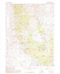
1987 Map of Rochester
USGS Topo · Published 1988About this map
Lower Rochester and Packard anchor the industrial landscape of this late-20th-century topographic survey, where the peaks of the Humboldt Range are marked by a dense concentration of mining operations. The map documents an intensive extraction history, from the Nevada Packard Mines in the south to the Humboldt Queen Mine and Champion Mine in the north. Significant mining infrastructure is detailed around Nenzel Hill Mine and the Rochester Mine (Dump), while an Old Railroad Grade snakes through the canyons, tracing the historical logistics of the district. The terrain transitions from the high elevations of Lone Mountain and Gold Mountain down into the broad expanses of Packard Flat and Sage Hen Flat, providing a comprehensive look at the relationship between geological features and the development of these Nevada mining camps.
Find a feature on this map
54 named features on this map. Tap any name to fly to it.
Don’t see what you’re looking for? This feature index may not catch every label — zoom into the map to look around manually.
Map Details
Editions of this 1987 Rochester Map
This is the sole edition of this map. No revisions or reprints were ever made.
Other maps of this area

1931 · Lovelock
USGS Topo · 1:250,000

1935 · Lovelock
USGS Topo · 1:250,000

1954 · Unionville
USGS Topo · 1:62,500

1954 · Buffalo Mtn
USGS Topo · 1:62,500

1955 · Lovelock
USGS Topo · 1:250,000

1956 · Oreana
USGS Topo · 1:62,500

1956 · Lovelock
USGS Topo · 1:62,500

1959 · Lovelock
USGS Topo · 1:250,000

1984 · Lovelock
USGS Topo · 1:100,000
1987 · Rye Patch Dam
USGS Topo · 1:24,000