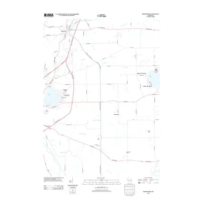
2013 Map of Rochester
USGS Topo · Published 2013About this map
The Fox River winds through this Racine County landscape, serving as a primary corridor for the village of Rochester and connecting several distinctive lakeside communities. In the early 21st century, the area is defined by its recreational and residential character, specifically around Browns Lake and Eagle Lake. These water bodies are surrounded by established developments like Cedar Park, Eagle Lake Terrace, and Eagle Lake Manor, which sit alongside local landmarks such as Camp MacLean and the Pan-Yak Golf Course. The map reveals a highly managed hydrological system including the Hoosier Cr Canal and Wind Lake Drainage Canal, reflecting the region's agricultural and drainage history. Beyond the residential clusters, features like Brightonwoods Orchard and Flaglor Airport highlight a mix of rural industry and specialized local infrastructure. Small topographical rises like Mt Tom punctuate the landscape between the river valley and the eastern lake districts.
Find a feature on this map
76 named features on this map. Tap any name to fly to it.
Don’t see what you’re looking for? This feature index may not catch every label — zoom into the map to look around manually.
Map Details
Editions of this 2013 Rochester Map
This is the sole edition of this map. No revisions or reprints were ever made.
Other maps of this area

1891 · Muskego
USGS Topo · 1:62,500

1892 · Eagle
USGS Topo · 1:62,500

1893 · Silver Lake
USGS Topo · 1:62,500

1893 · Geneva
USGS Topo · 1:62,500

1894 · Eagle
USGS Topo · 1:62,500

1897 · Eagle
USGS Topo · 1:62,500

1901 · Muskego
USGS Topo · 1:62,500

1904 · Lake Geneva
USGS Topo · 1:62,500

1906 · Eagle
USGS Topo · 1:62,500

1906 · Silver Lake
USGS Topo · 1:62,500