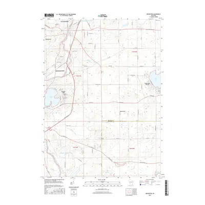
2016 Map of Rochester
USGS Topo · Published 2016About this map
The Fox River valley anchors this Racine County landscape, where the settlements of Waterford, Rochester, and northern Burlington cluster along its banks. The terrain reflects a complex hydrologic history, defined by a network of drainage systems including the Wind Lake Drainage Canal and the Hoosier Cr Canal. These engineered waterways cut through a landscape dotted with kettle lakes and wetlands, most notably Browns Lake and the residential shoreline of Eagle Lake at Eagle Lake Manor. Southward, the map transitions across the boundary into Kenosha County, marked by the rise of Mt Tom and the waters of Vern Wolf Lake. Genealogists and local historians will find the Rochester Cem located north of the village center, while the layout of early arterial roads like Milwaukee Ave and Durand Ave illustrates the region's connection to larger Wisconsin trade centers.
Find a feature on this map
81 named features on this map. Tap any name to fly to it.
Don’t see what you’re looking for? This feature index may not catch every label — zoom into the map to look around manually.
Map Details
Editions of this 2016 Rochester Map
This is the sole edition of this map. No revisions or reprints were ever made.
Other maps of this area

1891 · Muskego
USGS Topo · 1:62,500

1892 · Eagle
USGS Topo · 1:62,500

1893 · Silver Lake
USGS Topo · 1:62,500

1893 · Geneva
USGS Topo · 1:62,500

1894 · Eagle
USGS Topo · 1:62,500

1897 · Eagle
USGS Topo · 1:62,500

1901 · Muskego
USGS Topo · 1:62,500

1904 · Lake Geneva
USGS Topo · 1:62,500

1906 · Eagle
USGS Topo · 1:62,500

1906 · Silver Lake
USGS Topo · 1:62,500