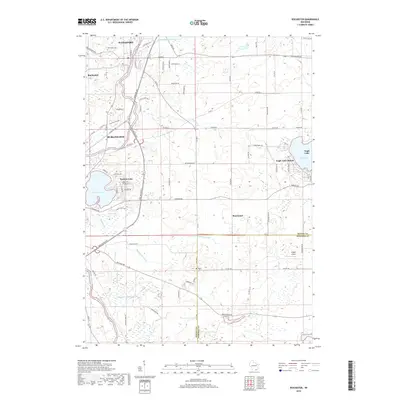
2018 Map of Rochester
USGS Topo · Published 2018About this map
The Fox River corridor anchors this portion of Racine County, where the historic settlements of Waterford, Rochester, and Burlington trace the waterway's path. This modern survey illustrates a landscape deeply shaped by drainage engineering, featuring an extensive network of artificial waterways including the Wind Lake Drainage Canal, Hoosier Cr Canal, and Hoosier-Br Canal. These systems manage the low-lying terrain between the river and the prominent basins of Eagle Lake and Browns Lake, which have supported residential growth in areas like Eagle Lake Manor.
Find a feature on this map
82 named features on this map. Tap any name to fly to it.
Don’t see what you’re looking for? This feature index may not catch every label — zoom into the map to look around manually.
Map Details
Editions of this 2018 Rochester Map
This is the sole edition of this map. No revisions or reprints were ever made.
Other maps of this area

1891 · Muskego
USGS Topo · 1:62,500

1892 · Eagle
USGS Topo · 1:62,500

1893 · Silver Lake
USGS Topo · 1:62,500

1893 · Geneva
USGS Topo · 1:62,500

1894 · Eagle
USGS Topo · 1:62,500

1897 · Eagle
USGS Topo · 1:62,500

1901 · Muskego
USGS Topo · 1:62,500

1904 · Lake Geneva
USGS Topo · 1:62,500

1906 · Eagle
USGS Topo · 1:62,500

1906 · Silver Lake
USGS Topo · 1:62,500