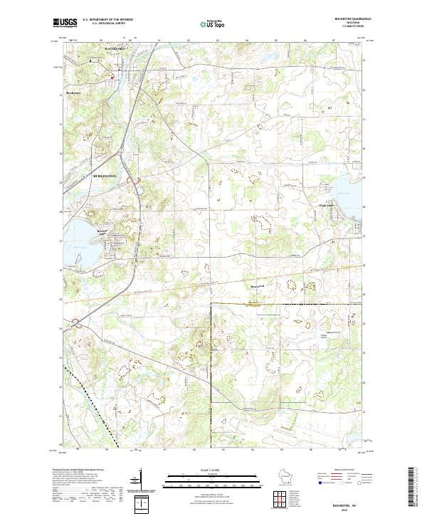
2022 Map of Rochester
USGS Topo · Published 2022About this map
The Fox River flows through the western portion of this Racine County landscape, connecting the established communities of Waterford, Rochester, and Burlington. This modern survey reflects the enduring importance of water management in the region, evidenced by the Wind Lake Drainage Canal and the extensive Hoosier Cr Canal system that cuts through the low-lying terrain. The eastern half of the quadrangle is dominated by the residential developments around Eagle Lake and Rosewood, while Browns Lake sits just south of the Burlington city limits. Local landmarks such as the Rochester Cem and Mt Tom provide historical and geographical points of reference. Transport and infrastructure are represented by the Burlington Byp and the presence of Flaglor Airport to the south, highlighting the mix of agricultural heritage and modern suburban expansion in southeast Wisconsin.
Find a feature on this map
85 named features on this map. Tap any name to fly to it.
Don’t see what you’re looking for? This feature index may not catch every label — zoom into the map to look around manually.
Map Details
Editions of this 2022 Rochester Map
This is the sole edition of this map. No revisions or reprints were ever made.
Other maps of this area

1891 · Muskego
USGS Topo · 1:62,500

1892 · Eagle
USGS Topo · 1:62,500

1893 · Silver Lake
USGS Topo · 1:62,500

1893 · Geneva
USGS Topo · 1:62,500

1894 · Eagle
USGS Topo · 1:62,500

1897 · Eagle
USGS Topo · 1:62,500

1901 · Muskego
USGS Topo · 1:62,500

1904 · Lake Geneva
USGS Topo · 1:62,500

1906 · Eagle
USGS Topo · 1:62,500

1906 · Silver Lake
USGS Topo · 1:62,500