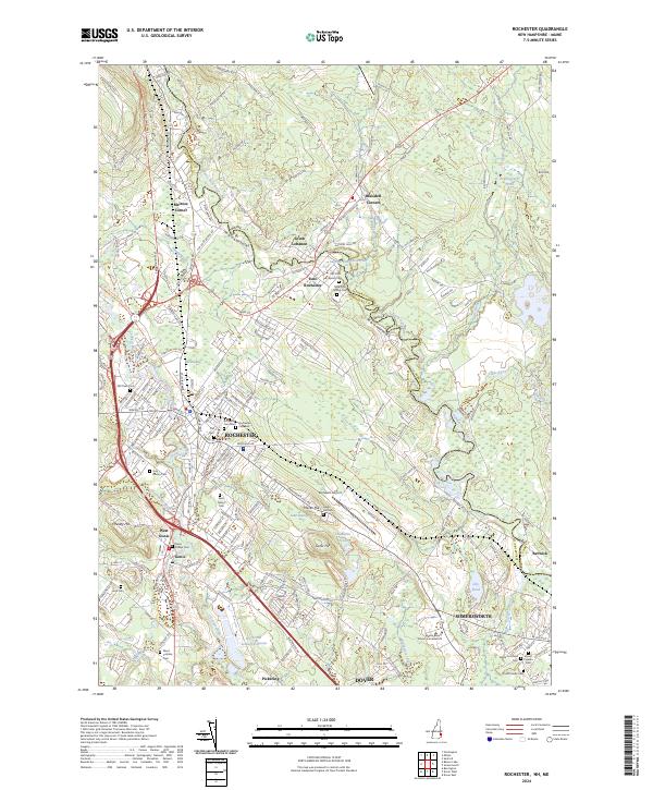
2024 Map of Rochester
USGS Topo · Published 2024About this map
The Cocheco River winds through the heart of this regional industrial and transport hub, where the Spaulding Tpke meets local routes like Ten Rod Rd. The landscape is a dense assembly of historic residential pockets and burial grounds, reflecting centuries of development in Rochester and its satellite communities like Gonic, East Rochester, and West Gonic. Local genealogists will find an exceptional density of cemeteries, including the centrally located Old Town Cem and the adjacent Rochester Cem West and Rochester Cem East. Along the eastern border, the Salmon Falls River and its Salmon River Reservoir trace the state line between New Hampshire and Maine. The map captures the infrastructure of the early 21st century, from the Rochester Sewage Lagoons and Skyhaven Airport to the educational presence of the Empire Beauty School-Somersworth near the southern boundary.
Find a feature on this map
59 named features on this map. Tap any name to fly to it.
Don’t see what you’re looking for? This feature index may not catch every label — zoom into the map to look around manually.
Map Details
Editions of this 2024 Rochester Map
This is the sole edition of this map. No revisions or reprints were ever made.
Other maps of this area

1891 · Berwick
USGS Topo · 1:62,500

1893 · Dover
USGS Topo · 1:62,500

1893 · Berwick
USGS Topo · 1:62,500

1916 · Dover
USGS Topo · 1:62,500

1917 · Mt. Pawtuckaway
USGS Topo · 1:62,500

1918 · Dover
USGS Topo · 1:62,500

1919 · Mt. Pawtuckaway
USGS Topo · 1:62,500

1919 · Alton
USGS Topo · 1:62,500

1933 · Berwick
USGS Topo · 1:48,000

1937 · Berwick
USGS Topo · 1:62,500