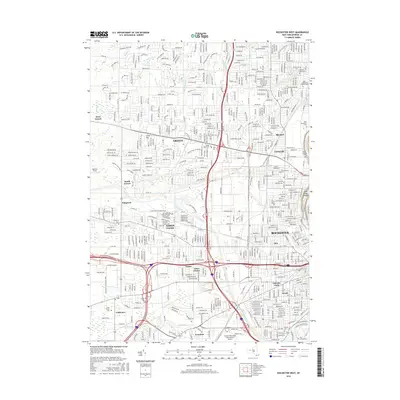
2016 Map of Rochester West
USGS Topo · Published 2016About this map
The Erie Canal cuts a distinctive diagonal path across this western Rochester landscape, separating the suburban growth of North Gates and Greece from the industrial and residential core of the city. The Genesee River forms the eastern boundary, featuring Seth Green Island and the historic Kings Landing Cem. This 2016 survey illustrates the modern transportation infrastructure that defines the region, from the extensive runways of the Greater Rochester International Airport to the Genesee & Wyoming RR corridor. Local history is anchored by numerous memorial sites, including the expansive Holy Sepulchre Cem and Beth Hamedresh Hagodel Cem. The map tracks the shift from established city neighborhoods like Otis and Lincoln Park to the developing residential tracts of West Greece and South Greece, providing a clear record of the area's contemporary geography and civic boundaries.
Find a feature on this map
68 named features on this map. Tap any name to fly to it.
Don’t see what you’re looking for? This feature index may not catch every label — zoom into the map to look around manually.
Map Details
Editions of this 2016 Rochester West Map
This is the sole edition of this map. No revisions or reprints were ever made.
Other maps of this area

1895 · Rochester
USGS Topo · 1:62,500

1895 · Ontario Beach
USGS Topo · 1:62,500

1898 · Rochester
USGS Topo · 1:62,500

1899 · Hamlin
USGS Topo · 1:62,500

1899 · Ontario Beach
USGS Topo · 1:62,500

1899 · Brockport
USGS Topo · 1:62,500

1912 · Rochester
USGS Topo · 1:62,500

1912 · Ontario Beach
USGS Topo · 1:62,500

1920 · Rochester
USGS Topo · 1:62,500

1931 · Mendon Ponds
USGS Topo · 1:24,000