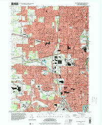
1994 Map of Rochester West
USGS Topo · Published 2000About this map
The Rochester Corporate Boundary defines the transition from dense urban development to the expanding suburbs of Greece and Gates during the mid-1990s. This industrial and residential corridor is anchored by the massive complex of the Rochester-Monroe Co Airport and the heavy rail infrastructure at Lincoln Park, where 6 Tracks converge near the Rochester Corp Bdy. The landscape is characterized by a high concentration of parochial institutions, such as St Bernards Seminary and Aquinas Institute, alongside historic burial grounds including Holy Sepulchre Cemetery and Riverside Cemetery. The Erie Canal cuts through the center of the sheet, serving as a landmark for the small settlements of South Greece and Elmgrove. The presence of numerous named schools, from Greece-Athena High Sch to Edison Sch, reflects the postwar educational infrastructure built to support these burgeoning communities near the Genesee River.
Find a feature on this map
96 named features on this map. Tap any name to fly to it.
Don’t see what you’re looking for? This feature index may not catch every label — zoom into the map to look around manually.
Map Details
Editions of this 1994 Rochester West Map
This is the sole edition of this map. No revisions or reprints were ever made.
Other maps of this area

1895 · Rochester
USGS Topo · 1:62,500

1895 · Ontario Beach
USGS Topo · 1:62,500

1898 · Rochester
USGS Topo · 1:62,500

1899 · Hamlin
USGS Topo · 1:62,500

1899 · Ontario Beach
USGS Topo · 1:62,500

1899 · Brockport
USGS Topo · 1:62,500

1912 · Rochester
USGS Topo · 1:62,500

1912 · Ontario Beach
USGS Topo · 1:62,500

1920 · Rochester
USGS Topo · 1:62,500

1931 · Mendon Ponds
USGS Topo · 1:24,000