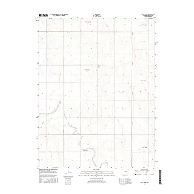
2016 Map of Rock Basin
USGS Topo · Published 2016About this map
Rush Creek meanders through the southern half of this landscape, carving a low-lying path through the high plains of Lincoln County. This 2016 survey highlights a sparsely populated region defined by wide-open depressions and seasonal watercourses, most notably the namesake Rock Basin and the adjacent Buffalo Basin. These geological features dominate the central terrain, offering a clear view of the natural drainage patterns in this part of eastern Colorado before the land rises toward the surrounding ridges.
Find a feature on this map
15 named features on this map. Tap any name to fly to it.
Don’t see what you’re looking for? This feature index may not catch every label — zoom into the map to look around manually.
Map Details
Editions of this 2016 Rock Basin Map
This is the sole edition of this map. No revisions or reprints were ever made.
Other maps of this area

1891 · Arroyo
USGS Topo · 1:125,000

1893 · Arroyo
USGS Topo · 1:125,000

1954 · Lamar
USGS Topo · 1:250,000

1958 · Lamar
USGS Topo · 1:250,000
1978 · Kinney Lake
USGS Topo · 1:24,000

1978 · Aroya
USGS Topo · 1:24,000

1978 · Barrel Springs Draw
USGS Topo · 1:24,000

1978 · Rock Basin
USGS Topo · 1:24,000

1978 · Stacy Lakes Draw
USGS Topo · 1:24,000
1978 · Boyero
USGS Topo · 1:24,000