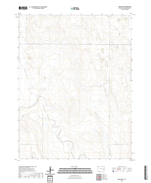
2022 Map of Rock Basin
USGS Topo · Published 2022About this map
Buffalo Basin and Rock Basin dominate the wide, semi-arid landscape of eastern Colorado on this 2022 survey. This Lincoln County quadrangle is characterized by a high-plains terrain where intermittent watercourses like Rush Cr meander through shallow valleys between low, broad ridges. The land is meticulously partitioned by the Public Land Survey System, with township and range lines forming a stark grid over the natural topography.
Find a feature on this map
14 named features on this map. Tap any name to fly to it.
Don’t see what you’re looking for? This feature index may not catch every label — zoom into the map to look around manually.
Map Details
Editions of this 2022 Rock Basin Map
This is the sole edition of this map. No revisions or reprints were ever made.
Other maps of this area

1891 · Arroyo
USGS Topo · 1:125,000

1893 · Arroyo
USGS Topo · 1:125,000

1954 · Lamar
USGS Topo · 1:250,000

1958 · Lamar
USGS Topo · 1:250,000
1978 · Kinney Lake
USGS Topo · 1:24,000

1978 · Aroya
USGS Topo · 1:24,000

1978 · Barrel Springs Draw
USGS Topo · 1:24,000

1978 · Rock Basin
USGS Topo · 1:24,000

1978 · Stacy Lakes Draw
USGS Topo · 1:24,000
1978 · Boyero
USGS Topo · 1:24,000