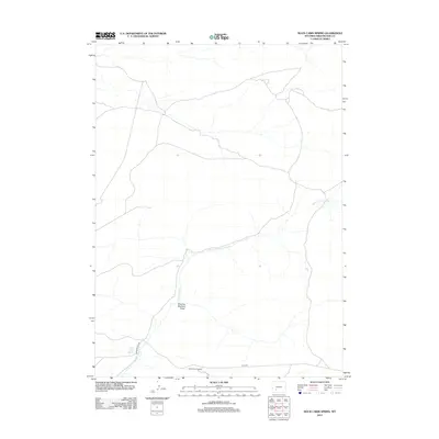
2012 Map of Rock Cabin Spring
USGS Topo · Published 2012About this map
Rock Cabin Spring and the surrounding high desert of Sweetwater County define this corner of Wyoming. The landscape is marked by ephemeral water systems like Rock Cabin Cr and the descriptively named Mowing Machine Draw, which hint at the seasonal ranching and agricultural history of the region. Transportation across this arid terrain is facilitated by unpaved routes such as Freighter Gap Rd and Bar X Rd, reflecting the sparse infrastructure common to the Red Desert area. Of particular note is the Rock Cabin Dugway, a feature indicative of early trail engineering used to navigate the steep transitions between draws and plateaus. This 2012 survey illustrates the persistent isolation of the area, where water sources and established tracks remain the primary landmarks for navigation and land use.
Find a feature on this map
6 named features on this map. Tap any name to fly to it.
Don’t see what you’re looking for? This feature index may not catch every label — zoom into the map to look around manually.
Map Details
Editions of this 2012 Rock Cabin Spring Map
This is the sole edition of this map. No revisions or reprints were ever made.
Other maps of this area

1955 · Lander
USGS Topo · 1:250,000

1958 · Lander
USGS Topo · 1:250,000

1958 · Parting of the Ways
USGS Topo · 1:62,500

1958 · Essex Mountain
USGS Topo · 1:62,500

1958 · Hay Meadow Reservoir
USGS Topo · 1:24,000

1958 · Pacific Springs
USGS Topo · 1:24,000

1958 · Freighter Gap
USGS Topo · 1:62,500

1958 · Dickie Springs
USGS Topo · 1:24,000

1961 · Lander
USGS Topo · 1:250,000
1980 · Farson
USGS Topo · 1:100,000