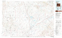
1980 Map of Farson
USGS Topo · Published 1981About this map
Farson and Eden serve as the primary hubs of the Eden Valley in this 1980 survey, where the arid high desert is transformed by the Big Sandy Reservoir and Eden Reservoir irrigation systems. The map documents a landscape defined by the crossing of the Continental Divide and the historic path of the Dry Sandy Stage and Pony Express Sta (Site) near Dry Sandy. To the south and east, the terrain shifts into the shifting Sand Dunes and the prominent Jack Morrow Hills, while the northwestern corner reaches into the Bridger National Forest. The map captures a unique intersection of early frontier transit routes and modern water management, showing how the Big Sandy River and Pacific Creek have been harnessed to support these small Sweetwater County agricultural communities.
Find a feature on this map
39 named features on this map. Tap any name to fly to it.
Don’t see what you’re looking for? This feature index may not catch every label — zoom into the map to look around manually.
Map Details
Editions of this 1980 Farson Map
This is the sole edition of this map. No revisions or reprints were ever made.
Other maps of this area

1939 · Big Piney
USGS Topo · 1:125,000

1942 · Big Piney
USGS Topo · 1:125,000

1953 · Christina Lake
USGS Topo · 1:24,000

1954 · Ogden
USGS Topo · 1:250,000

1954 · Rock Springs
USGS Topo · 1:250,000

1955 · Preston
USGS Topo · 1:250,000

1955 · Lander
USGS Topo · 1:250,000

1958 · Lander
USGS Topo · 1:250,000

1958 · Ogden
USGS Topo · 1:250,000

1958 · Rock Springs
USGS Topo · 1:250,000