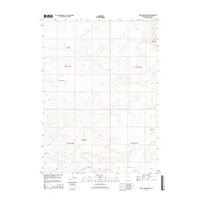
2015 Map of Rock Cabin Spring
USGS Topo · Published 2015About this map
The Continental Divide defines the high elevation and drainage patterns of this high-desert landscape in Sweetwater County. The terrain is characterized by the prominent Jack Morrow Hills and the steep escarpment of Joe Hay Rim, features that dictate the sparse human infrastructure and rugged natural boundaries of the region. Water remains the most critical resource here, evidenced by Rock Cabin Spring and the drainage network of Rock Cabin Cr and Alkali Wash. This survey captures the remote character of the area at a time when access was limited to essential corridors like Bar X Rd and Cr 83. The map's layout highlights the intersection of traditional land survey townships and the natural geography of Mowing Machine Draw, providing a detailed reference for those studying the land use and hydrology of the Wyoming sagebrush steppe.
Find a feature on this map
13 named features on this map. Tap any name to fly to it.
Don’t see what you’re looking for? This feature index may not catch every label — zoom into the map to look around manually.
Map Details
Editions of this 2015 Rock Cabin Spring Map
This is the sole edition of this map. No revisions or reprints were ever made.
Other maps of this area

1955 · Lander
USGS Topo · 1:250,000

1958 · Lander
USGS Topo · 1:250,000

1958 · Parting of the Ways
USGS Topo · 1:62,500

1958 · Essex Mountain
USGS Topo · 1:62,500

1958 · Hay Meadow Reservoir
USGS Topo · 1:24,000

1958 · Pacific Springs
USGS Topo · 1:24,000

1958 · Freighter Gap
USGS Topo · 1:62,500

1958 · Dickie Springs
USGS Topo · 1:24,000

1961 · Lander
USGS Topo · 1:250,000
1980 · Farson
USGS Topo · 1:100,000