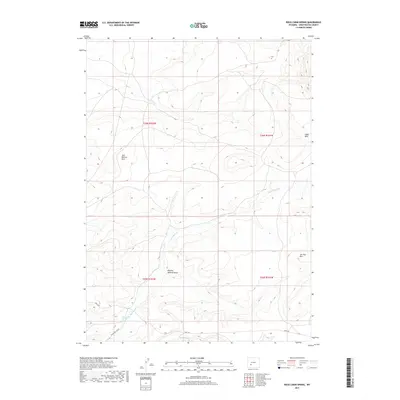
2017 Map of Rock Cabin Spring
USGS Topo · Published 2017About this map
Rock Cabin Spring and its namesake drainage, Rock Cabin Cr, define this high-desert landscape in the northeastern reach of Sweetwater County. The terrain is characterized by dramatic elevation changes across the Jack Morrow Hills and the prominent Joe Hay Rim to the east. These features suggest a region shaped by intermittent water flow and wind erosion, typical of the Wyoming basin. Evidence of historical land use and transit appears in the southern portion of the sheet, where Bar X Rd and Freighter Gap Rd cross the arid landscape. The presence of Mowing Machine Draw provides a subtle nod to past agricultural or ranching activities in an area otherwise dominated by open rangeland and the seasonal drainage of Alkali Wash.
Find a feature on this map
12 named features on this map. Tap any name to fly to it.
Don’t see what you’re looking for? This feature index may not catch every label — zoom into the map to look around manually.
Map Details
Editions of this 2017 Rock Cabin Spring Map
This is the sole edition of this map. No revisions or reprints were ever made.
Other maps of this area

1955 · Lander
USGS Topo · 1:250,000

1958 · Lander
USGS Topo · 1:250,000

1958 · Parting of the Ways
USGS Topo · 1:62,500

1958 · Essex Mountain
USGS Topo · 1:62,500

1958 · Hay Meadow Reservoir
USGS Topo · 1:24,000

1958 · Pacific Springs
USGS Topo · 1:24,000

1958 · Freighter Gap
USGS Topo · 1:62,500

1958 · Dickie Springs
USGS Topo · 1:24,000

1961 · Lander
USGS Topo · 1:250,000
1980 · Farson
USGS Topo · 1:100,000