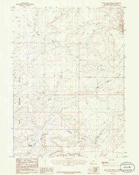
1986 Map of Rock Cabin Spring
USGS Topo · Published 1986About this map
The Continental Divide cuts through the high desert of Sweetwater County in this mid-1980s provisional survey. The landscape is defined by the Morrow Jack Hills and a complex network of seasonal watercourses and drainage basins. Remote and primarily undeveloped, the area reflects the arid character of the Wyoming basin, where small landmarks like Rock Cabin Spring provided vital water points for cattlemen and early travelers. The geography is carved by distinctive topographic features such as Mowing Machine Draw and Machine Draw, which feed into the larger Rock Cabin Creek system. This document preserves the late-century surveying of these open lands, capturing the precise contours and intermittent washes like Alkali Wash before the era of modern digital mapping.
Find a feature on this map
7 named features on this map. Tap any name to fly to it.
Don’t see what you’re looking for? This feature index may not catch every label — zoom into the map to look around manually.
Map Details
Editions of this 1986 Rock Cabin Spring Map
This is the sole edition of this map. No revisions or reprints were ever made.
Other maps of this area

1955 · Lander
USGS Topo · 1:250,000

1958 · Lander
USGS Topo · 1:250,000

1958 · Parting of the Ways
USGS Topo · 1:62,500

1958 · Essex Mountain
USGS Topo · 1:62,500

1958 · Hay Meadow Reservoir
USGS Topo · 1:24,000

1958 · Pacific Springs
USGS Topo · 1:24,000

1958 · Freighter Gap
USGS Topo · 1:62,500

1958 · Dickie Springs
USGS Topo · 1:24,000

1961 · Lander
USGS Topo · 1:250,000
1980 · Farson
USGS Topo · 1:100,000