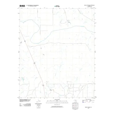
2010 Map of Rock Canyon
USGS Topo · Published 2010About this map
The Brazos River carves a winding path across this portion of Baylor County, creating the distinctive Horseshoe Bend as it flows toward the east. This landscape is defined by its drainage network, where tributaries like Millers Creek, Turkey Creek, and Deep Creek feed into the primary river valley. The terrain transitions from these riparian corridors to the higher elevations of Rock Canyon and the prominent summit of Twin Mountain in the south.
Find a feature on this map
21 named features on this map. Tap any name to fly to it.
Don’t see what you’re looking for? This feature index may not catch every label — zoom into the map to look around manually.
Map Details
Editions of this 2010 Rock Canyon Map
This is the sole edition of this map. No revisions or reprints were ever made.
Other maps of this area

1954 · Wichita Falls
USGS Topo · 1:250,000

1958 · Wichita Falls
USGS Topo · 1:250,000

1962 · Antelope Creek SE
USGS Topo · 1:24,000

1962 · Antelope Creek NE
USGS Topo · 1:24,000

1966 · Seymour West
USGS Topo · 1:24,000

1966 · Westover SE
USGS Topo · 1:24,000

1966 · Rock Canyon
USGS Topo · 1:24,000

1966 · Westover SW
USGS Topo · 1:24,000

1966 · Seymour East
USGS Topo · 1:24,000
1966 · Cope Branch
USGS Topo · 1:24,000