
1966 Map of Rock Canyon
USGS Topo · Published 1968About this map
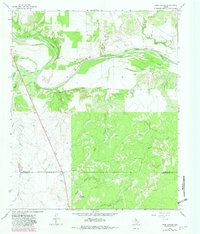
The Brazos River creates a wide, meandering path through this North Texas landscape, defining the transition between Baylor and Throckmorton Counties. The river's path is marked by sharp geographic features like Horseshoe Bend and the eponymous Rock Canyon. This 1960s survey captures a rural landscape where agricultural infrastructure, such as several Storage Bins, and natural landmarks like Twin Mountain dominate the terrain.
Find a feature on this map
16 named features on this map. Tap any name to fly to it.
Don’t see what you’re looking for? This feature index may not catch every label — zoom into the map to look around manually.
Map Details
Editions of this 1966 Rock Canyon Map
2 editions found
Other maps of this area

1954 · Wichita Falls
USGS Topo · 1:250,000

1958 · Wichita Falls
USGS Topo · 1:250,000

1962 · Antelope Creek SE
USGS Topo · 1:24,000

1962 · Antelope Creek NE
USGS Topo · 1:24,000

1966 · Seymour West
USGS Topo · 1:24,000

1966 · Westover SE
USGS Topo · 1:24,000

1966 · Westover SW
USGS Topo · 1:24,000

1966 · Seymour East
USGS Topo · 1:24,000
1966 · Cope Branch
USGS Topo · 1:24,000
1966 · Westover
USGS Topo · 1:24,000