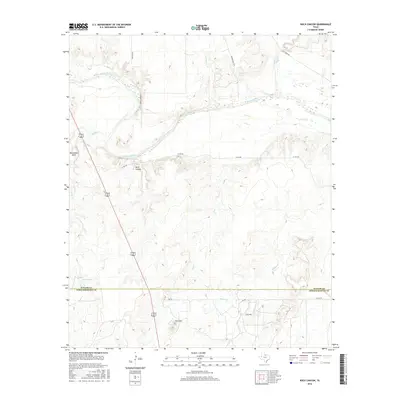
2016 Map of Rock Canyon
USGS Topo · Published 2016About this map
The Brazos River winds through this North Texas landscape, defining a series of sharp meanders including the prominent Horseshoe Bend. This 2016 survey captures the borderlands between Baylor and Throckmorton counties, a region primarily shaped by agricultural ranching and water management. The topography is anchored by Twin Mtn in the south, while the name-giving Rock Canyon sits just south of the river.
Find a feature on this map
22 named features on this map. Tap any name to fly to it.
Don’t see what you’re looking for? This feature index may not catch every label — zoom into the map to look around manually.
Map Details
Editions of this 2016 Rock Canyon Map
This is the sole edition of this map. No revisions or reprints were ever made.
Other maps of this area

1954 · Wichita Falls
USGS Topo · 1:250,000

1958 · Wichita Falls
USGS Topo · 1:250,000

1962 · Antelope Creek SE
USGS Topo · 1:24,000

1962 · Antelope Creek NE
USGS Topo · 1:24,000

1966 · Seymour West
USGS Topo · 1:24,000

1966 · Westover SE
USGS Topo · 1:24,000

1966 · Rock Canyon
USGS Topo · 1:24,000

1966 · Westover SW
USGS Topo · 1:24,000

1966 · Seymour East
USGS Topo · 1:24,000
1966 · Cope Branch
USGS Topo · 1:24,000