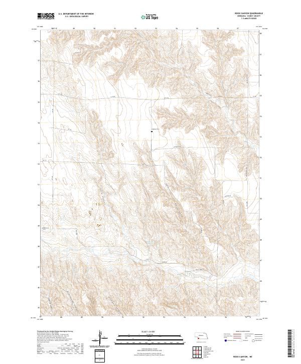
2021 Map of Rock Canyon
USGS Topo · Published 2021About this map
Rock Canyon and its network of deep-cut drainages define the landscape of this southwestern Nebraska quadrangle. The topography is dominated by dramatic erosional features like Kelly Gulch and Blackwater Canyon, which funnel toward the ephemeral flow of Muddy Cr in the north and the expansive flats of Indian Creek Rd in the south. The placement of Highland Cem along the central ridge line suggests the historical location of community centers now marked primarily by rural road intersections. Transport across this terrain relies on a grid of section-line roads, such as 14th Ave and Rd 716, while the modern Max-Wauneta Rd provides the primary north-south corridor through the breaks. Water management is evidenced by Anderson Reservoir, a critical resource in a region defined by its dry canyons and seasonal washes.
Find a feature on this map
26 named features on this map. Tap any name to fly to it.
Don’t see what you’re looking for? This feature index may not catch every label — zoom into the map to look around manually.
Map Details
Editions of this 2021 Rock Canyon Map
This is the sole edition of this map. No revisions or reprints were ever made.
Other maps of this area

1954 · McCook
USGS Topo · 1:250,000

1957 · McCook
USGS Topo · 1:250,000

1958 · McCook
USGS Topo · 1:250,000

1961 · Benkelman
USGS Topo · 1:24,000
1962 · Max SE
USGS Topo · 1:24,000

1962 · Max NE
USGS Topo · 1:24,000
1962 · Max
USGS Topo · 1:24,000

1973 · Ough
USGS Topo · 1:24,000

1973 · Wauneta SW
USGS Topo · 1:24,000
1973 · Rock Canyon
USGS Topo · 1:24,000