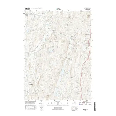
2016 Map of Rock City
USGS Topo · Published 2016About this map
Rock City and Milan serve as central hubs in this northern Dutchess County landscape, where the rolling geography is defined by the drainage of the Saw Kill and Little Wappinger Cr. The area is notably dense with historical burial sites, ranging from the Quaker Burial Ground Thorpe Cem to the Yeoman Burial Ground, reflecting generations of settled farming families. Aviation history is prominent here, with both the Sky Park Airport and the Old Rhinebeck Airport situated near the western edge of the map. Between the heights of Mt Concert and Old Roundtop, the terrain is punctuated by significant water bodies such as Silver Lake and Long Pond. The road network, including the Salisbury Tpke, connects small hamlets like Bulls Head and Wurtemburg, illustrating the enduring transit patterns of the Hudson Valley uplands.
Find a feature on this map
140 named features on this map. Tap any name to fly to it.
Don’t see what you’re looking for? This feature index may not catch every label — zoom into the map to look around manually.
Map Details
Editions of this 2016 Rock City Map
This is the sole edition of this map. No revisions or reprints were ever made.
Other maps of this area

1895 · Catskill
USGS Topo · 1:62,500

1898 · Rhinebeck
USGS Topo · 1:62,500

1899 · Millbrook
USGS Topo · 1:62,500

1902 · Millbrook
USGS Topo · 1:62,500

1902 · Copake
USGS Topo · 1:62,500

1904 · Copake
USGS Topo · 1:62,500

1934 · Rhinebeck
USGS Topo · 1:48,000

1934 · Catskill
USGS Topo · 1:62,500

1938 · Catskill
USGS Topo · 1:62,500

1939 · Rhinebeck
USGS Topo · 1:62,500