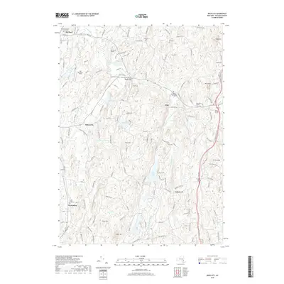
2019 Map of Rock City
USGS Topo · Published 2019About this map
Red Hook and its surrounding hamlets are defined by a complex network of burial grounds and family-named terrain in this part of Dutchess County. The landscape is dotted with ancestral sites like the Quaker Burial Ground - Thorpe Cem and Saint Paul's Lutheran Cem, reflecting the deep sectarian and familial roots of the local community. These settlements, including Wurtemburg and Rock City, are connected by historic routes like the Salisbury Tpke, while the Old Rhinebeck Airport and Sky Park Airport suggest the region's long-standing connection to early aviation.
Find a feature on this map
75 named features on this map. Tap any name to fly to it.
Don’t see what you’re looking for? This feature index may not catch every label — zoom into the map to look around manually.
Map Details
Editions of this 2019 Rock City Map
This is the sole edition of this map. No revisions or reprints were ever made.
Other maps of this area

1895 · Catskill
USGS Topo · 1:62,500

1898 · Rhinebeck
USGS Topo · 1:62,500

1899 · Millbrook
USGS Topo · 1:62,500

1902 · Millbrook
USGS Topo · 1:62,500

1902 · Copake
USGS Topo · 1:62,500

1904 · Copake
USGS Topo · 1:62,500

1934 · Rhinebeck
USGS Topo · 1:48,000

1934 · Catskill
USGS Topo · 1:62,500

1938 · Catskill
USGS Topo · 1:62,500

1939 · Rhinebeck
USGS Topo · 1:62,500