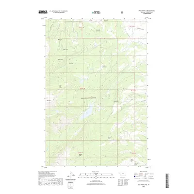
2020 Map of Rock Creek Lake
USGS Topo · Published 2020About this map
Deerlodge National Forest dominates this landscape in Powell County, where the high terrain is carved by complex water management systems and glacial features. The map illustrates a high-altitude network of resource extraction and irrigation infrastructure, including the Old China Ditch, Pauly Ditch, and the Kohrs-and-Bielenberg Ditch, which trace the contours of the slopes to move water across the divide. Centered on Rock Creek Lake and the dramatic Rock Creek Falls, the topography rises to distinctive summits like Pikes Peak and Ballard Hill. The presence of South America Park and Willow Creek Park suggests traditional high-country grazing or clearing areas, while names like French Gulch and Pioneer Gulch point to the region's early prospecting and settlement history.
Find a feature on this map
46 named features on this map. Tap any name to fly to it.
Don’t see what you’re looking for? This feature index may not catch every label — zoom into the map to look around manually.
Map Details
Editions of this 2020 Rock Creek Lake Map
This is the sole edition of this map. No revisions or reprints were ever made.
Other maps of this area

1889 · Helena
USGS Topo · 1:250,000

1893 · Helena
USGS Topo · 1:250,000

1899 · Helena
USGS Topo · 1:250,000

1903 · Helena
USGS Topo · 1:250,000

1908 · Philipsburg
USGS Topo · 1:125,000

1919 · Drummond
USGS Topo · 1:125,000

1921 · Drummond
USGS Topo · 1:125,000

1947 · Butte
USGS Topo · 1:250,000

1958 · Butte
USGS Topo · 1:250,000

1958 · Drummond
USGS Topo · 1:62,500