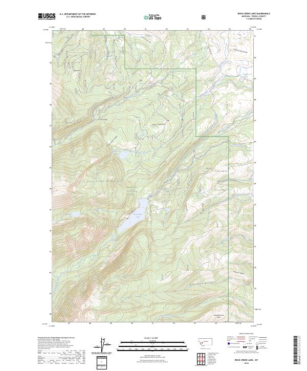
2024 Map of Rock Creek Lake
USGS Topo · Published 2024About this map
Deerlodge National Forest covers much of this high country in the Flint Creek Range, where high-altitude water management is a defining characteristic of the landscape. A complex network of irrigation systems, including the Old China Ditch, Rohrs and Bielenberg Ditch, and Pauly Ditch, reveals the historical efforts to move water from alpine sources like Rock Creek Lake and Doney Lake to distant lands. The topography is marked by significant drainages such as Pikes Peak Creek and French Gulch, which descend from high ridges like Emery Ridge and Pikes Peak Ridge. The area around South America Park and Robinson Gulch highlights the remote nature of these mountain basins, supported by a system of rugged access points like Gold Creek-Lakes Rd and various logging routes.
Find a feature on this map
42 named features on this map. Tap any name to fly to it.
Don’t see what you’re looking for? This feature index may not catch every label — zoom into the map to look around manually.
Map Details
Editions of this 2024 Rock Creek Lake Map
This is the sole edition of this map. No revisions or reprints were ever made.
Other maps of this area

1889 · Helena
USGS Topo · 1:250,000

1893 · Helena
USGS Topo · 1:250,000

1899 · Helena
USGS Topo · 1:250,000

1903 · Helena
USGS Topo · 1:250,000

1908 · Philipsburg
USGS Topo · 1:125,000

1919 · Drummond
USGS Topo · 1:125,000

1921 · Drummond
USGS Topo · 1:125,000

1947 · Butte
USGS Topo · 1:250,000

1958 · Butte
USGS Topo · 1:250,000

1958 · Drummond
USGS Topo · 1:62,500