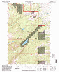
1996 Map of Rock Creek Lake
USGS Topo · Published 1998About this map
Rock Creek Lake sits at the center of this mountain landscape, which is heavily shaped by both public forest management and state institutions. Located within the Deerlodge National Forest, the terrain is defined by the prominent Pikes Peak Ridge and Pikes Peak, where a high-altitude drainage system feeds Doney Lake and Moose Lake. A significant portion of the eastern landscape falls within the State Prison Ranch, indicating a unique historical land-use pattern where correctional agriculture met the high timberline.
Find a feature on this map
36 named features on this map. Tap any name to fly to it.
Don’t see what you’re looking for? This feature index may not catch every label — zoom into the map to look around manually.
Map Details
Editions of this 1996 Rock Creek Lake Map
This is the sole edition of this map. No revisions or reprints were ever made.
Other maps of this area

1889 · Helena
USGS Topo · 1:250,000

1893 · Helena
USGS Topo · 1:250,000

1899 · Helena
USGS Topo · 1:250,000

1903 · Helena
USGS Topo · 1:250,000

1908 · Philipsburg
USGS Topo · 1:125,000

1919 · Drummond
USGS Topo · 1:125,000

1921 · Drummond
USGS Topo · 1:125,000

1947 · Butte
USGS Topo · 1:250,000

1958 · Butte
USGS Topo · 1:250,000

1958 · Drummond
USGS Topo · 1:62,500