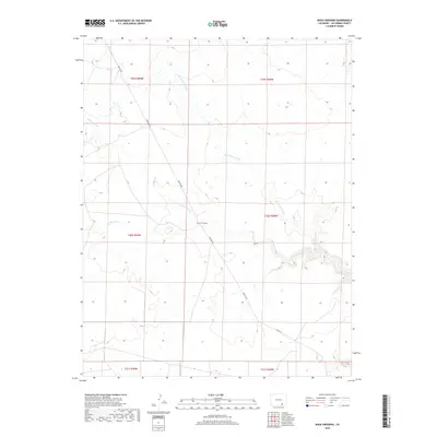
2019 Map of Rock Crossing
USGS Topo · Published 2019About this map
Big Water Arroyo and Taylor Arroyo carve a series of deep, winding drainage patterns through this high plains landscape of Las Animas County. The namesake Rock Crossing settlement is situated near the center of the sheet, where Pipeline Rd intersects the northern reaches of the Taylor Arroyo drainage system. This 2019 survey documents the modern infrastructure of the region, including the linear path of Pipeline Rd and Co Rd 143 in the southern portion of the quadrangle. The land is largely defined by its township and range divisions, showing the enduring grid of the Public Land Survey System across the arid terrain of southeastern Colorado.
Find a feature on this map
12 named features on this map. Tap any name to fly to it.
Don’t see what you’re looking for? This feature index may not catch every label — zoom into the map to look around manually.
Map Details
Editions of this 2019 Rock Crossing Map
This is the sole edition of this map. No revisions or reprints were ever made.
Other maps of this area

1891 · Timpas
USGS Topo · 1:125,000

1891 · Apishapa
USGS Topo · 1:125,000

1891 · Mesa De Maya
USGS Topo · 1:125,000

1892 · Elmoro
USGS Topo · 1:125,000

1893 · Apishapa
USGS Topo · 1:125,000

1893 · Elmoro
USGS Topo · 1:125,000

1893 · Mesa de Maya
USGS Topo · 1:125,000

1894 · Timpas
USGS Topo · 1:125,000

1897 · Elmoro
USGS Topo · 1:125,000

1897 · Apishapa
USGS Topo · 1:125,000