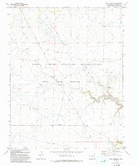
1993 Map of Rock Crossing
USGS Topo · Published 1993About this map
The Fort Carson Military Reservation (Piñon Canyon Maneuver Site) dominates this high-plains landscape, which was updated in the early 1990s to reflect military use and topographic detail. The terrain is defined by deep incisions from ephemeral watercourses, most notably Big Water Arroyo and the winding Taylor Arroyo. These natural drainages converge near the landmark known as Rock Crossing, a site suggesting a historical point of transit across the arroyo system. Infrastructure within the maneuver site is sparse, consisting largely of the Pipeline Road and scattered water sources such as a Spring, several labeled wells, and a Water Tank. The map illustrates the transition of traditional ranching land into a large-scale military training area, preserving the names of the hydraulic features that remain central to navigating this arid environment.
Find a feature on this map
10 named features on this map. Tap any name to fly to it.
Don’t see what you’re looking for? This feature index may not catch every label — zoom into the map to look around manually.
Map Details
Editions of this 1993 Rock Crossing Map
This is the sole edition of this map. No revisions or reprints were ever made.
Other maps of this area

1891 · Timpas
USGS Topo · 1:125,000

1891 · Apishapa
USGS Topo · 1:125,000

1891 · Mesa De Maya
USGS Topo · 1:125,000

1892 · Elmoro
USGS Topo · 1:125,000

1893 · Apishapa
USGS Topo · 1:125,000

1893 · Elmoro
USGS Topo · 1:125,000

1893 · Mesa de Maya
USGS Topo · 1:125,000

1894 · Timpas
USGS Topo · 1:125,000

1897 · Elmoro
USGS Topo · 1:125,000

1897 · Apishapa
USGS Topo · 1:125,000