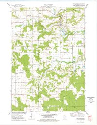
1975 Map of Rock Falls
USGS Topo · Published 1978About this map
Rock Springs stands at the heart of this mid-1970s survey, where the Chicago and North Western railway follows the winding path of the Baraboo River. This landscape is defined by the prominent ridges of the North Range and Reedsburg Range, revealing a countryside deeply engaged in extraction and agriculture. Numerous quarries dot the hillsides, particularly around the settlement of La Rue and along the Mid-Continent Railway.
Find a feature on this map
63 named features on this map. Tap any name to fly to it.
Don’t see what you’re looking for? This feature index may not catch every label — zoom into the map to look around manually.
Map Details
Editions of this 1975 Rock Falls Map
This is the sole edition of this map. No revisions or reprints were ever made.
Other maps of this area

1929 · Durand
USGS Topo · 1:62,500

1932 · Durand
USGS Topo · 1:62,500

1932 · Mondovi
USGS Topo · 1:62,500

1934 · Elk Mound
USGS Topo · 1:62,500

1936 · Elk Mound
USGS Topo · 1:62,500

1940 · Menomonie
USGS Topo · 1:62,500

1942 · Menomonie
USGS Topo · 1:62,500

1953 · Eau Claire
USGS Topo · 1:250,000

1958 · Eau Claire
USGS Topo · 1:250,000

1964 · Eau Claire
USGS Topo · 1:250,000