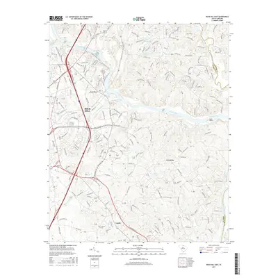
2017 Map of Rock Hill East
USGS Topo · Published 2017About this map
The Catawba River flows through the heart of this region, separating the industrial and academic growth of Rock Hill from the rural landscapes of the York and Lancaster county line. The western bank is defined by infrastructure, including the Technical Coll and the rail corridors of the Norfolk Southern railroad. Settlement patterns follow the river's path and major road crossings, with Red River established near the confluence of Manchester Creek. To the south, the community of Lesslie and landmarks like Hopewell Cem and Catawba Church reflect the long-standing social fabric of the area. East of the river, the terrain becomes more varied with smaller tributaries like Four Mile Cr and Burgis Cr winding toward Goat Island, highlighting the natural barriers that once shaped local development and land use before modern bridge crossings connected these communities.
Find a feature on this map
263 named features on this map. Tap any name to fly to it.
Don’t see what you’re looking for? This feature index may not catch every label — zoom into the map to look around manually.
Map Details
Editions of this 2017 Rock Hill East Map
This is the sole edition of this map. No revisions or reprints were ever made.
Other maps of this area

1905 · Charlotte
USGS Topo · 1:48,000

1907 · Charlotte
USGS Topo · 1:62,500

1941 · Charlotte
USGS Topo · 1:125,000

1941 · Spartanburg
USGS Topo · 1:250,000

1942 · Charlotte
USGS Topo · 1:125,000

1947 · Clover
USGS Topo · 1:62,500

1949 · Clover
USGS Topo · 1:62,500

1949 · Rock Hill
USGS Topo · 1:62,500

1953 · Spartanburg
USGS Topo · 1:250,000

1953 · Charlotte
USGS Topo · 1:250,000