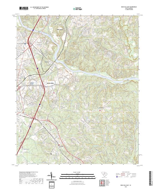
2024 Map of Rock Hill East
USGS Topo · Published 2024About this map
The Catawba River serves as the central artery for this York County corridor, winding between the growing urban centers of Rock Hill and Fort Mill. This modern survey illustrates the contemporary evolution of historic crossings and settlements, where names like Herrons Ferry and Red River denote earlier points of transit and commerce along the riverbanks. The landscape is a mix of dense residential development and pockets of rural legacy, particularly evident near the community of Friendship and the southern settlement of Lesslie.
Find a feature on this map
28 named features on this map. Tap any name to fly to it.
Don’t see what you’re looking for? This feature index may not catch every label — zoom into the map to look around manually.
Map Details
Editions of this 2024 Rock Hill East Map
This is the sole edition of this map. No revisions or reprints were ever made.
Other maps of this area

1905 · Charlotte
USGS Topo · 1:48,000

1907 · Charlotte
USGS Topo · 1:62,500

1941 · Charlotte
USGS Topo · 1:125,000

1941 · Spartanburg
USGS Topo · 1:250,000

1942 · Charlotte
USGS Topo · 1:125,000

1947 · Clover
USGS Topo · 1:62,500

1949 · Clover
USGS Topo · 1:62,500

1949 · Rock Hill
USGS Topo · 1:62,500

1953 · Spartanburg
USGS Topo · 1:250,000

1953 · Charlotte
USGS Topo · 1:250,000