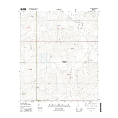
2015 Map of Rock Hill
USGS Topo · Published 2015About this map
De Soto National Forest encompasses a large portion of this landscape where the boundaries of Lamar, Forrest, and Pearl River counties meet. The small settlement of Rock Hill serves as a central point, surrounded by a dense network of timber roads and family-named routes such as AB Keith Rd and Charlie Anderson Rd. This 2015 survey reveals a land defined by its drainages, where the meandering Black Creek and its many tributaries, including Little Black Cr and Potato Cr, create a complex hydrologic system through the pine woods. Genealogists will find a high density of rural burial sites, including Rock Hill Cem, Slade Cem, and Simmons Cem, many tucked away along winding forest tracks like Rockhill Lumberton Rd. The southern portion of the map is dominated by the Pistol Ridge area, illustrating the enduring relationship between local industry and the Mississippi forest landscape.
Find a feature on this map
62 named features on this map. Tap any name to fly to it.
Don’t see what you’re looking for? This feature index may not catch every label — zoom into the map to look around manually.
Map Details
Editions of this 2015 Rock Hill Map
This is the sole edition of this map. No revisions or reprints were ever made.
Other maps of this area

1947 · Wiggins
USGS Topo · 1:62,500

1947 · New Augusta
USGS Topo · 1:62,500

1949 · Wiggins
USGS Topo · 1:62,500

1949 · New Augusta
USGS Topo · 1:62,500

1953 · Hattiesburg
USGS Topo · 1:250,000

1953 · Mobile
USGS Topo · 1:250,000

1957 · Mobile
USGS Topo · 1:250,000

1958 · Hattiesburg
USGS Topo · 1:250,000

1958 · Carnes
USGS Topo · 1:62,500

1960 · Mobile
USGS Topo · 1:250,000