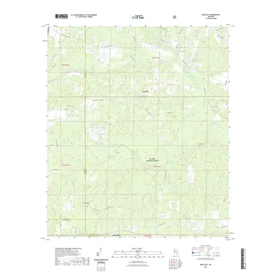
2021 Map of Rock Hill
USGS Topo · Published 2021About this map
Rock Hill and the surrounding piney woods of the De Soto National Forest define this corner of Forrest County. The landscape is heavily dissected by the winding tributaries of the Black Creek system, including Little Black Creek, Potato Cr, and Cameron Cr. This map reveals a distributed rural settlement pattern typical of the South Mississippi upland, where family history is anchored by numerous small burial grounds such as Anderson Cem, Simmons Cem, and Rock Hill Cem. Significant elevation changes are noted along Pistol Ridge, which runs through the southwestern portion of the sheet. The network of timber roads and connectors, including Rockhill Lumberton Rd and Pumping Station Rd, reflects the area's long-standing connection to the forest products industry and rural transit between Purvis and Brooklyn.
Find a feature on this map
57 named features on this map. Tap any name to fly to it.
Don’t see what you’re looking for? This feature index may not catch every label — zoom into the map to look around manually.
Map Details
Editions of this 2021 Rock Hill Map
This is the sole edition of this map. No revisions or reprints were ever made.
Other maps of this area

1947 · Wiggins
USGS Topo · 1:62,500

1947 · New Augusta
USGS Topo · 1:62,500

1949 · Wiggins
USGS Topo · 1:62,500

1949 · New Augusta
USGS Topo · 1:62,500

1953 · Hattiesburg
USGS Topo · 1:250,000

1953 · Mobile
USGS Topo · 1:250,000

1957 · Mobile
USGS Topo · 1:250,000

1958 · Hattiesburg
USGS Topo · 1:250,000

1958 · Carnes
USGS Topo · 1:62,500

1960 · Mobile
USGS Topo · 1:250,000