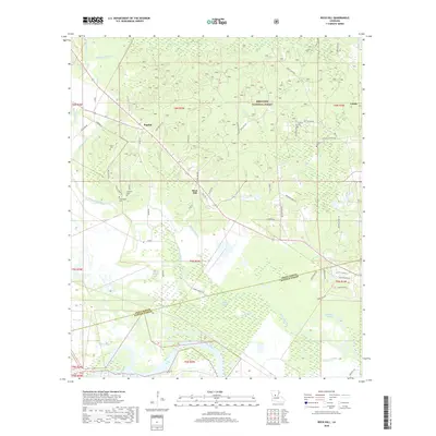
2018 Map of Rock Hill
USGS Topo · Published 2018About this map
Bagdad and Rock Hill anchor this portion of central Louisiana where the pine lands of the Kisatchie National Forest meet the alluvial wetlands of the Red River. The landscape is defined by a dense network of slow-moving waterways, including Bayou Rigolette and Saline Bayou, which carve through the low-lying terrain. Genealogy researchers will find several family-named landmarks and burial sites, such as Cruikshank Cem and Anthony Cem, tucked away off local routes like Bagdad Loop and Florida Tademy Rd. The map illustrates the transition from the upland timber country in the north to the sprawling marshy basins of Walden Bayou and Caney Bayou in the south, reflecting a traditional Louisiana landscape of timber management and river-bottom agriculture.
Find a feature on this map
64 named features on this map. Tap any name to fly to it.
Don’t see what you’re looking for? This feature index may not catch every label — zoom into the map to look around manually.
Map Details
Editions of this 2018 Rock Hill Map
This is the sole edition of this map. No revisions or reprints were ever made.
Other maps of this area

1932 · Boyce NE
USGS Topo · 1:31,680

1932 · Boyce SW
USGS Topo · 1:31,680

1932 · Colfax SW
USGS Topo · 1:31,680

1932 · Colfax SE
USGS Topo · 1:31,680

1936 · Colfax
USGS Topo · 1:62,500

1936 · Pollock
USGS Topo · 1:62,500

1941 · Alexandria
USGS Topo · 1:62,500

1941 · Pollock
USGS Topo · 1:62,500

1941 · Boyce
USGS Topo · 1:62,500

1945 · Boyce SE
USGS Topo · 1:31,680