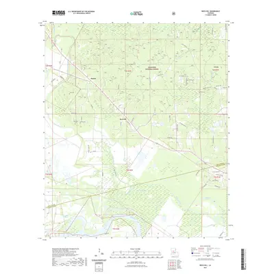
2021 Map of Rock Hill
USGS Topo · Published 2021About this map
Red River currents and the intricate wetlands of Bayou Rigolette define this portion of the Louisiana landscape on the border of Grant and Rapides Parishes. The southern half of the map is dominated by the expansive bayou systems, including Saline Bayou, Walden Bayou, and Caney Bayou, which snake through the low-lying alluvial plains. To the north, the terrain transitions into the upland pine woods of the Kisatchie National Forest.
Find a feature on this map
65 named features on this map. Tap any name to fly to it.
Don’t see what you’re looking for? This feature index may not catch every label — zoom into the map to look around manually.
Map Details
Editions of this 2021 Rock Hill Map
This is the sole edition of this map. No revisions or reprints were ever made.
Other maps of this area

1932 · Boyce NE
USGS Topo · 1:31,680

1932 · Boyce SW
USGS Topo · 1:31,680

1932 · Colfax SW
USGS Topo · 1:31,680

1932 · Colfax SE
USGS Topo · 1:31,680

1936 · Colfax
USGS Topo · 1:62,500

1936 · Pollock
USGS Topo · 1:62,500

1941 · Alexandria
USGS Topo · 1:62,500

1941 · Pollock
USGS Topo · 1:62,500

1941 · Boyce
USGS Topo · 1:62,500

1945 · Boyce SE
USGS Topo · 1:31,680