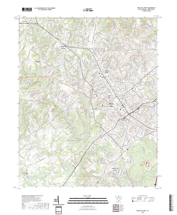
2024 Map of Rock Hill West
USGS Topo · Published 2024About this map
The western edges of Rock Hill and the community of Ebenezer anchor this South Carolina landscape, where the suburban expansion of York County meets the drainage basins of Fishing Creek and Wildcat Creek. This modern survey details the significant educational and civic institutions of the area, including the campuses of Winthrop University and Clinton College, alongside several major burial grounds like Laurelwood Cem and Grand View Memorial Park.
Find a feature on this map
329 named features on this map. Tap any name to fly to it.
Don’t see what you’re looking for? This feature index may not catch every label — zoom into the map to look around manually.
Map Details
Editions of this 2024 Rock Hill West Map
This is the sole edition of this map. No revisions or reprints were ever made.
Other maps of this area

1905 · Charlotte
USGS Topo · 1:48,000

1907 · Charlotte
USGS Topo · 1:62,500

1941 · Charlotte
USGS Topo · 1:125,000

1941 · Spartanburg
USGS Topo · 1:250,000

1942 · Charlotte
USGS Topo · 1:125,000

1947 · Clover
USGS Topo · 1:62,500

1949 · Clover
USGS Topo · 1:62,500

1949 · Rock Hill
USGS Topo · 1:62,500

1953 · Spartanburg
USGS Topo · 1:250,000

1953 · Charlotte
USGS Topo · 1:250,000