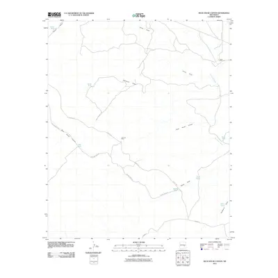
2010 Map of Rock House Canyon
USGS Topo · Published 2010About this map
Arroyo del Macho and its various tributaries define the drainage patterns of this high desert landscape in Chaves County. This 2010 survey highlights a remote rangeland punctuated by essential water sources for livestock, including Gavi Tank, China Tank, and the CCC Tank. The presence of these named earthen reservoirs reveals the continued importance of water management in an arid environment where ranching remains the primary activity.
Find a feature on this map
19 named features on this map. Tap any name to fly to it.
Don’t see what you’re looking for? This feature index may not catch every label — zoom into the map to look around manually.
Map Details
Editions of this 2010 Rock House Canyon Map
This is the sole edition of this map. No revisions or reprints were ever made.
Other maps of this area

1955 · Roswell
USGS Topo · 1:250,000

1958 · Roswell
USGS Topo · 1:250,000

1962 · Roswell
USGS Topo · 1:250,000

1962 · Rock House Canyon
USGS Topo · 1:24,000

1962 · Panther Hill
USGS Topo · 1:24,000

1962 · Marley Draw
USGS Topo · 1:24,000
1963 · Barn Draw
USGS Topo · 1:24,000

1967 · Round Mountain SE
USGS Topo · 1:24,000
1967 · White Flat SE
USGS Topo · 1:24,000
1967 · Mesa SE
USGS Topo · 1:24,000