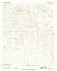
1967 Map of White Flat SE
USGS Topo · Published 1971About this map
Water infrastructure defines the landscape of Chaves County in the late 1960s, where survival and ranching operations rely on a network of isolated wells and windmills. The drainage of Salt Creek and the deep cut of Chimney Canyon organize the terrain, which is dotted with remote outposts like Childress Ranch and Corn Ranch. This 1967 field-checked survey reveals the scattered locations of critical resources such as Partnership Windmill, Big Creek Windmill, and New Windmill. These specific points of interest illustrate how the cattle industry utilized even the most arid sections of the High Plains, with named landmarks like Koy Ranch and South Windmill serving as vital navigational and logistical hubs in a region otherwise characterized by sparse settlement and ephemeral water features.
Find a feature on this map
16 named features on this map. Tap any name to fly to it.
Don’t see what you’re looking for? This feature index may not catch every label — zoom into the map to look around manually.
Map Details
Editions of this 1967 White Flat SE Map
2 editions found
Other maps of this area

1949 · Corn Ranch
USGS Topo · 1:24,000

1950 · Corn Ranch
USGS Topo · 1:24,000

1955 · Roswell
USGS Topo · 1:250,000

1958 · Roswell
USGS Topo · 1:250,000

1962 · Roswell
USGS Topo · 1:250,000

1962 · Horseshoe Bend
USGS Topo · 1:62,500

1962 · Rock House Canyon
USGS Topo · 1:24,000
1963 · Barn Draw
USGS Topo · 1:24,000

1967 · White Flat
USGS Topo · 1:24,000
1967 · Elsie Canyon
USGS Topo · 1:24,000