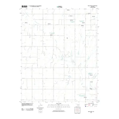
2009 Map of Rock Mary
USGS Topo · Published 2009About this map
Rock Mary rises as the central landmark of this Caddo County landscape, a prominent sandstone formation documented during nineteenth-century expeditions and later recorded in this 2009 survey. The terrain is defined by a dense network of water management projects, including numerous flood-control structures such as the Sugar Creek Site 12 Dam and the Fast Runner Site 1 Dam. These engineering efforts transformed the natural drainage of Sugar Creek and Dead Woman Creek into a series of managed basins like the Sugar Creek Site 29 Reservoir.
Find a feature on this map
42 named features on this map. Tap any name to fly to it.
Don’t see what you’re looking for? This feature index may not catch every label — zoom into the map to look around manually.
Map Details
Editions of this 2009 Rock Mary Map
This is the sole edition of this map. No revisions or reprints were ever made.
Other maps of this area

1942 · Geary
USGS Topo · 1:62,500

1951 · Binger
USGS Topo · 1:62,500

1955 · Clinton
USGS Topo · 1:250,000

1957 · Clinton
USGS Topo · 1:250,000

1961 · Eakly
USGS Topo · 1:62,500

1964 · Weatherford
USGS Topo · 1:62,500

1979 · Hinton
USGS Topo · 1:24,000

1979 · Sickles
USGS Topo · 1:24,000
1979 · Binger
USGS Topo · 1:24,000
1979 · Geary South
USGS Topo · 1:24,000