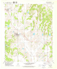
1979 Map of Binger
USGS Topo · Published 1979About this map
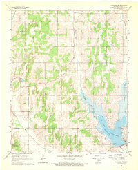
Binger serves as the central hub of this Caddo County landscape, characterized by a complex network of waterways including Sugar Creek, Kickapoo Creek, and Medicine Creek. The settlement pattern reflects the agricultural and infrastructural development of the late 1970s, with features such as Sewage Disposal Ponds and a Substa supporting the town. To the northwest, the smaller community of Lookeba sits near the drainage of Devils Canyon.
Find a feature on this map
28 named features on this map. Tap any name to fly to it.
Don’t see what you’re looking for? This feature index may not catch every label — zoom into the map to look around manually.
Map Details
Editions of this 1979 Binger Map
2 editions found
Other maps of this area

1893 · Buggy Creek
USGS Topo · 1:62,500

1945 · Anadarko
USGS Topo · 1:62,500

1951 · Binger
USGS Topo · 1:62,500

1951 · Fort Cobb
USGS Topo · 1:62,500

1955 · Clinton
USGS Topo · 1:250,000

1957 · Clinton
USGS Topo · 1:250,000
1967 · Cogar
USGS Topo · 1:24,000
1967 · Cogar NW
USGS Topo · 1:24,000
1968 · Anadarko NW
USGS Topo · 1:24,000

1979 · Hinton
USGS Topo · 1:24,000