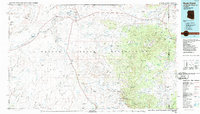
1986 Map of Rock Point
USGS Topo · Published 1987About this map
The Navajo Indian Reservation dominates this 1986 survey, covering a vast intersection where Arizona, New Mexico, Utah, and Colorado meet. The landscape is defined by the massive Carrizo Mountains and Chuska Mountains, which rise above a network of desert washes including Chinle Wash and Walker Creek. Small settlements like Dennehotso and Rock Point are scattered across the high desert, connected by early infrastructure such as a powerline and pipeline.
Find a feature on this map
78 named features on this map. Tap any name to fly to it.
Don’t see what you’re looking for? This feature index may not catch every label — zoom into the map to look around manually.
Map Details
Editions of this 1986 Rock Point Map
2 editions found
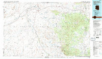
Other maps of this area

1883 · Marsh Pass
USGS Topo · 1:250,000

1886 · Henry Mountains
USGS Topo · 1:250,000

1886 · Abajo
USGS Topo · 1:250,000

1889 · Chaco
USGS Topo · 1:250,000

1892 · Marsh Pass
USGS Topo · 1:250,000

1892 · Abajo
USGS Topo · 1:250,000

1892 · Henry Mountains
USGS Topo · 1:250,000

1892 · Chaco
USGS Topo · 1:250,000

1892 · Canyon De Chelly
USGS Topo · 1:250,000

1893 · Abajo
USGS Topo · 1:250,000